Land Surveying
Innovative solutions to mapping your land.
In the Advanced Design Survey Department, our expertise in the civil design process elevates our surveying and mapping capabilities. Our skilled personnel and crews are trained to proactively anticipate design requirements in the field.
With extensive experience in working with the Rapid City community and surrounding areas, we establish effective interfaces with City and County personnel, other design professionals, regulatory agencies, contractors, and individual landowners.
Advanced Design has a team with three licensed Land Surveyors, ready to assist you with your surveying needs.

Boundary Surveys
Topographic Mapping
ALTA/NSPS Land Title Surveys
Subdivisions and Platting
Survey Services
Easement Exhibits
Elevation Certificates
Construction Staking
Mortgage Surveys

-
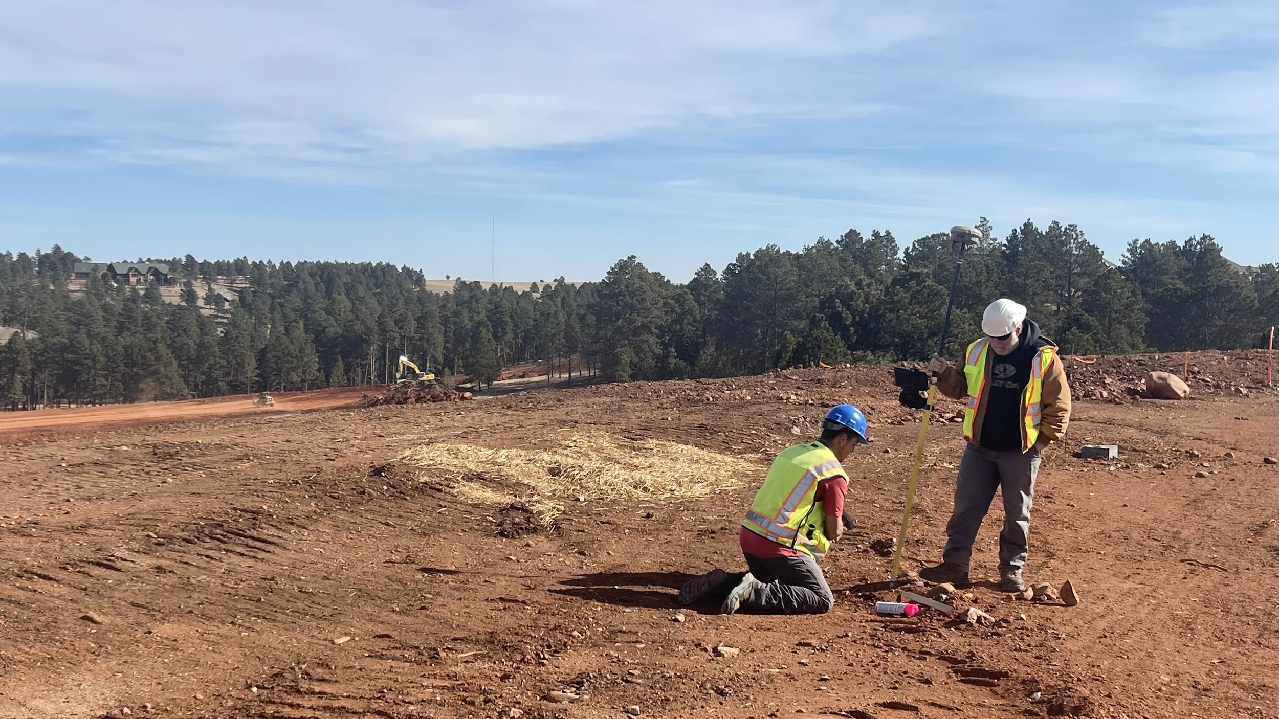
Accurately defining property boundaries is crucial for legal purposes. Our boundary surveys employ accurate measurements and analysis to establish precise property lines. Using advanced surveying equipment and techniques, our surveyors thoroughly research property records and conduct on-site surveys to determine property boundaries and mark them with physical markers. We provide detailed boundary survey reports and maps to ensure clarity and compliance with regulatory requirements.
-
Our topographic mapping services offer comprehensive and detailed representations of your site’s natural and manufactured features. We use advanced surveying technology to capture accurate data points regarding elevation, contours, vegetation, structures, and other relevant details. This information creates precise topographic maps that aid site planning, engineering design, and construction projects. Our topographic maps provide valuable insights into the terrain, facilitating informed decision-making and efficient project execution.
-
When purchasing or refinancing commercial properties, ALTA/NSPS land title surveys are essential to identify encroachments, easements, zoning issues, or other potential liabilities. Our expert surveyors conduct thorough surveys by the American Land Title Association (ALTA) and National Society of Professional Surveyors (NSPS) standards. We provide detailed reports and maps that meet the specific requirements of title insurance companies, lenders, and attorneys, ensuring a smooth transaction process.
-
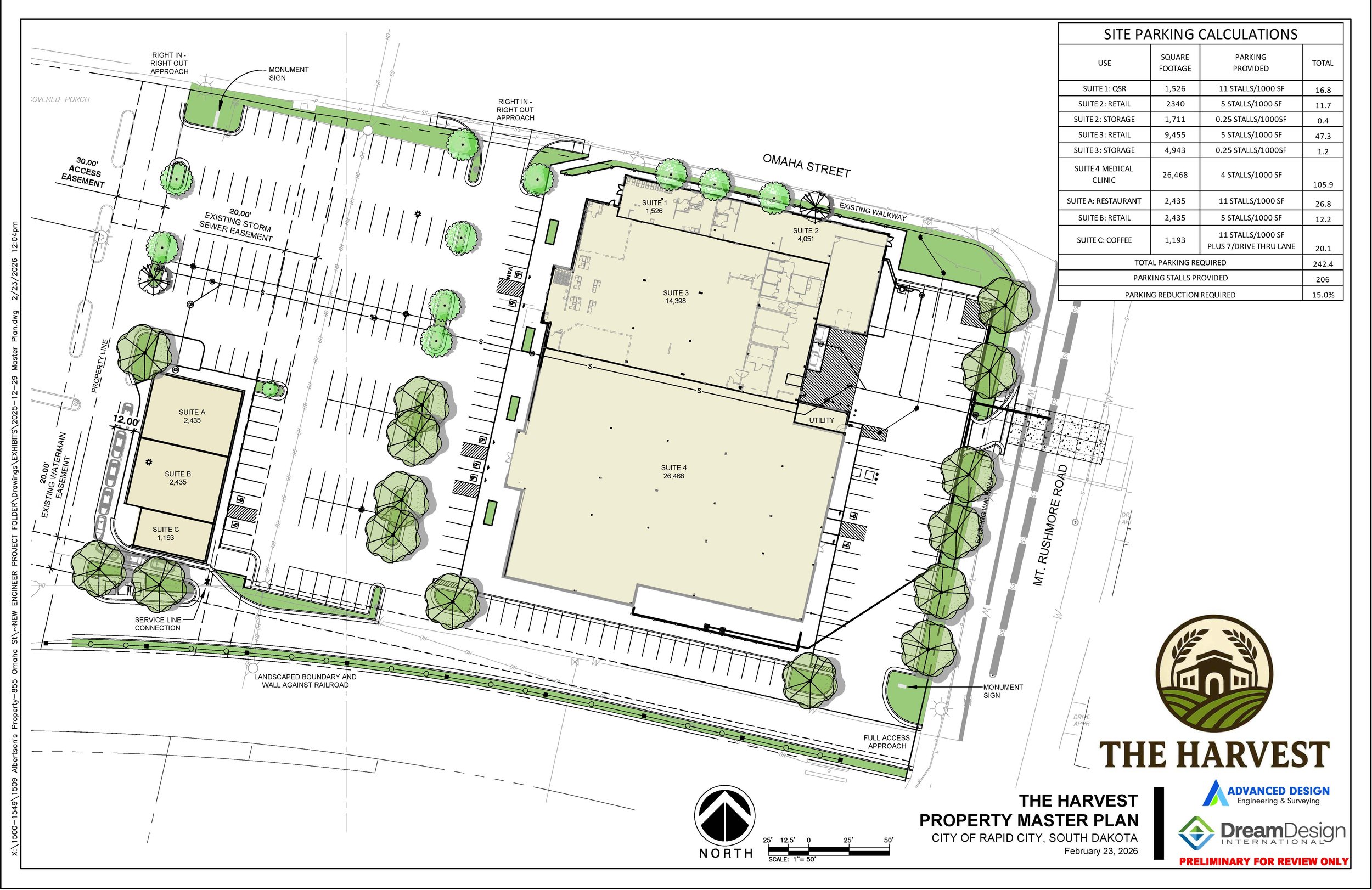
If you’re considering subdividing a larger tract of land into smaller parcels, our subdivision, and platting services are here to help you. We navigate the complex regulatory requirements and provide expert guidance throughout the subdivision process. Our experienced surveyors prepare accurate subdivision plats, ensuring compliance with local regulations and standards. We work closely with you to make the subdivision process easier and provide you with the necessary documentation for property transfers or development.
-
Easement exhibits are vital for documenting and establishing rights of way or access rights over a property. Our surveyors specialize in creating precise easement exhibits that clearly illustrate easement locations, dimensions, and extent. Whether you require exhibits for utility easements, access rights, or other purposes, we ensure accuracy and compliance with legal requirements. Our detailed easement exhibits facilitate property transactions, development projects, and property management.
-
For properties located in flood-prone areas, obtaining accurate elevation certificates is crucial for insurance purposes and compliance with FEMA regulations. Our surveyors conduct thorough elevation surveys and provide certified elevation certificates that document structures’ height and relationship to the Base Flood Elevation (BFE). With our precise elevation data, you can accurately assess flood risks, determine insurance premiums, and demonstrate compliance with local building codes.
-
Our construction staking services ensure the accurate and precise placement of structures and infrastructure during construction. Our surveyors work closely with contractors and project teams to mark exact locations for building corners and infrastructure elements based on construction plans. We accurately stake out reference points, building corners, utilities, roads, and other project components using advanced surveying techniques and equipment. Our construction staking services help minimize errors, improve efficiency, and ensure that construction projects align with design specifications and property boundaries.